
Smyrna ZIP Code Coverage
Only one locally verified postal ZIP belongs in a Smyrna ZIP code directory based on the official material reviewed. The town, county, and state addresses support the ZIP below. The result is intentionally narrow. A postal service area can extend beyond a legal town polygon, so an address using this ZIP should still be checked in county GIS and, when needed, the town’s boundary layer.
| ZIP | Areas Covered | Post Office | Notes |
|---|---|---|---|
| 37167 | Smyrna town and the surrounding postal delivery area verified in town, county, and state addresses | Not located in official sources | Postal ZIP does not equal the legal town polygon; county GIS ZIP and ZIP4 fields can include addresses outside town limits. |
No official citywide list was located for every ZIP serving Smyrna addresses. The research did not verify another ZIP, a post-office or station name, a PO-box-only ZIP, a unique ZIP, a split or realignment year, or a complete boundary description. Adding those details from commercial ZIP lists would overstate what official sources establish.
Smyrna ZIP Code Source Limits
The source limit is a practical part of accurate postal research. Use 37167 as a verified starting point, not as a claim that every address bearing a Smyrna postal label lies in town. ZIP delivery geography does not follow municipal lines, and the research found no evidence for a locally verified alternative ZIP or a complete station list. It also found no evidence for a local PO-box, unique-ZIP, or boundary-change record that could be responsibly added here.
For an individual address, resolve the actual mailing result before making a location claim. Then compare the county address point, town-limits layer, parcel, and any official record at issue. A ZIP code narrows a geographic question. It does not prove a household, owner, voter, business, or legal jurisdiction by itself. That distinction is especially important around growing municipal edges, where a town polygon, a county parcel, an urban-growth boundary, and a delivery area can overlap without sharing the same line. Preserve the exact address and its date whenever a historical record is being compared.
Smyrna USPS Address Modes
The USPS ZIP Code Lookup offers three useful directions. By Address checks a street address and returns its postal ZIP. By City and State returns ZIPs for a postal city. Cities by ZIP reverses the question. Use the exact street name and unit when known. USPS warns that a result does not confirm a person or company exists at the address and does not guarantee an actual business location.
| USPS field or mode | Use for a Smyrna address |
|---|---|
| By Address | Use Street Address, City, and State; Company and Apartment/Suite/Other are optional, as is an existing ZIP. |
| Find or Go | Runs the address-to-ZIP query after the required address fields are supplied. |
| By City and State | Checks ZIPs associated with a postal city label, not a town-boundary determination. |
| Cities by ZIP | Reverses the query from a ZIP to its postal-city information. |
USPS standardizes delivery information. It does not decide parcel ownership, a tax mailing destination, or whether the physical property lies inside the Town of Smyrna. Those questions belong to the county and town record layers.
Smyrna GIS ZIP and ZIP4 Fields
The Rutherford County SiteAddressPoint layer provides the most specific local address geography. It exposes address, municipality, ZIP, ZIP4, emergency-service number, PSAP, address authority, coordinates, subdivision, and review fields. ZIP and ZIP4 are useful spatial attributes, not resident-name fields. A municipality value, such as SMYRNA, and a postal ZIP can be compared for an exact address instead of assumed to match.
The county SiteAddressPoint layer is the source of this view.
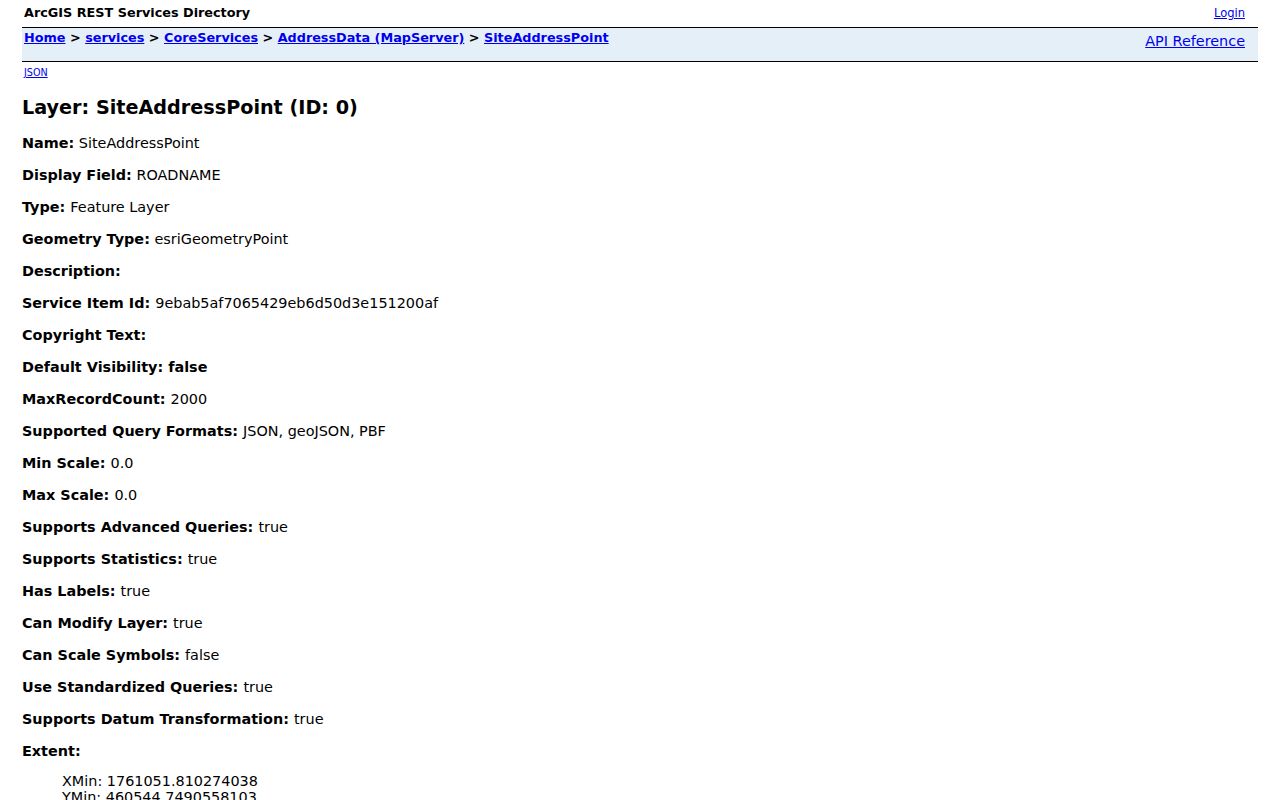
The address layer makes a mismatch testable: compare ZIP and ZIP4 with the municipality, PSAP, and address authority before carrying an address into another public record.
Smyrna ZIP Code Search Limits
ZIP is not a direct person-search filter in the official forms reviewed. The Rutherford assessor advanced search accepts parcel, owner, street name and number, neighborhood, values, building details, and book or page fields, but no ZIP field was visible. ZIP-wide assessor work therefore starts with GIS geography, then uses street, neighborhood, parcel, or owner details to open individual property records.
The statewide voter form has the opposite design: it requires Rutherford County, first name, last name, birth month, and birth year. It does not offer a ZIP filter or a ZIP-wide resident result. The Tennessee Property Assessment Data screen similarly exposes address, owner, parcel, and sort controls without a visible ZIP search. These are deliberate limits, not missing steps in a postal lookup.
Finding Residents by Smyrna ZIP Code
A ZIP-first search works best as a geographic prefilter. It narrows the address question before a parcel or name search. The official sources do not publish a public ZIP-wide household list, so keep every result tied to the specific record source and its date. Once a verified address is in hand, use a street-level parcel workflow rather than assuming the ZIP creates a resident roster.
- Use USPS By Address with the complete street address and unit to confirm the postal ZIP.
- Query the county GIS address point and record its ZIP, ZIP4, municipality, PSAP, and address-authority fields.
- Carry the street, parcel, or neighborhood detail into the assessor search to review an owner of record and situs field.
- Use the voter form only when an exact name and birth month and year are available, not to browse a ZIP.
- Compare the final parcel and town-boundary result when a legal town location matters.
After the ZIP is narrowed to a street and parcel, use the Smyrna street directory for the address-by-address record trail. The change from geographic filter to parcel research matters because the assessor and voter systems do not publish the same fields or search modes. Keep the postal result, map result, and parcel result as separate notes rather than combining them into a claim about a current resident.
Smyrna Postal and Town Boundaries
Smyrna can mean several different geographies: a postal city and ZIP, the Town of Smyrna legal polygon, a Rutherford County municipality value, and a Census place. The town’s GIS layers add Town Limits, Urban Growth Boundary, zoning, and subdivisions to that comparison. Both county and town map providers warn that their maps are not certified or legally binding, so a map answer should be independently checked when a formal determination is needed.
The Town of Smyrna GIS landing page is the source of this view.

Use the town layer beside the county address point, rather than relying on a postal label to answer a town-limits question.
Smyrna Address Record Definitions
Several address labels can appear in the same record trail and mean different things. Keeping them separate prevents a common local mismatch: an owner’s tax-mailing address may be elsewhere, a postal ZIP may cross the town boundary, and a deed may rely on lot or metes-and-bounds language rather than a current house number.
- ZIP and ZIP+4
- A ZIP identifies a broad postal delivery area. ZIP+4 adds a smaller delivery segment for a more precise mailing address.
- PO-box ZIP
- A ZIP assigned for post-office boxes. No locally verified Smyrna PO-box ZIP was located in the research.
- Unique ZIP
- A ZIP used for one organization or institution. No locally verified Smyrna unique ZIP was located.
- Carrier route
- A postal delivery route within a ZIP. It is not a town boundary or a public household list.
- Situs, mailing, and legal description
- Situs is the property location; mailing is where correspondence goes; a legal description identifies land by lot, subdivision, or metes and bounds.
Local mismatch. A Smyrna ZIP can describe postal delivery outside the legal town, while a town parcel can have a different mailing or legal-description field.
Smyrna Williamsport Address Change
Address history can change even when a ZIP stays familiar. February 2025 Smyrna Planning material discussed a development-specific proposal to rename part of Williamsport Drive and change every house number along that portion, subject to E911 approval. It is not evidence of a townwide renumbering, and the research does not establish that every proposed change was completed. It does show why an older deed, permit, or directory entry may need both old and proposed street-name searches.
When an address trail breaks, preserve the original spelling and number, compare the parcel ID, and test the current street in county GIS. The parcel identifier and legal description often survive a street-number change better than a postal address. Use the applicable local planning, mapping, and emergency-addressing channels for a specific historic-address question.
Smyrna ZIP Code Requests
When an address record is missing from a public screen, ask the custodian for the exact record rather than asking it to create a ZIP directory. The Town of Smyrna open-records process links its request channel for town-held material such as planning or permit records. Tennessee Public Records Act guidance explains that a request should identify the records sought, whether inspection or copies are wanted, and how delivery should occur.
For a county layer, parcel, or voter question, contact the responsible county office and name the address, parcel, date range, field sought, and reason the location needs clarification. The special voter-record statute can control access beyond the general public-records process. A custodian may redact protected data, provide an existing record rather than an analysis, or report that no responsive record exists.
Note: A precise request has a better chance of locating an existing record than a broad request for everyone within a ZIP.